


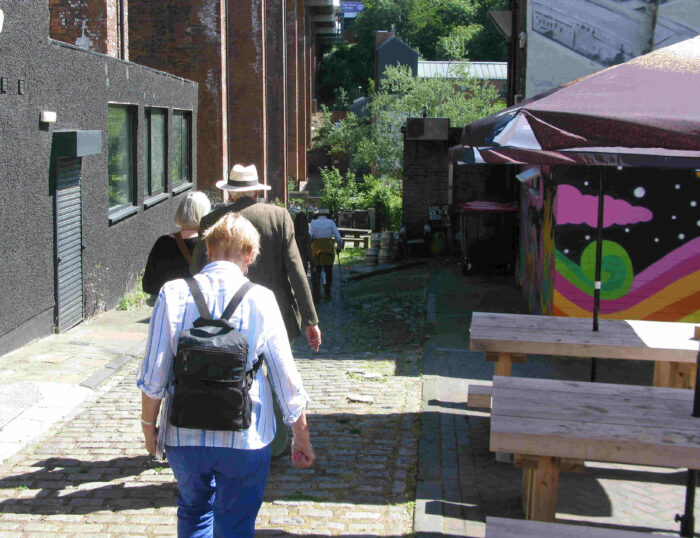
One of the most interesting areas of Newcastle upon Tyne is the Ouseburn Valley, locally known simply as Ouseburn. Just over a mile east of the city centre, the valley is named after the river Ouseburn (more often seen as a fast-flowing shallow stream) which flows into the river Tyne.
Heart of the industrial revolution
This area is considered as at one time the heart of the industrial revolution in Newcastle. A cluster of different industries lined the banks of the burn over different periods, from flax spinning, lead production and pottery making to glass objects and more. And of course there was the inevitable involvement in shipping coal.
In glass production alone, Newcastle was for a time a leading production centre, supplying glass containers for a variety of different industries. The food and drink market was one, glass containers preceded the tin can as means of storing perishable foods. Dundee Marmalade jam-jars for example were supplied from Newcastle.
One site, on the west bank of the Ouseburn where it joins the Tyne, shows the evolution of industry here. According to an Ordnance Survey map in 1868, the site up to this time had been occupied by corn mills and brickworks, Yet by 1870 it had become a livestock sanatorium, a large brick building with vents in place of windows, where live sheep and cattle landed in the country from abroad were housed initially to check that they were not carrying disease. Newcastle was a centre for imported meat (predominantly from Scandinavia) at the time.
Lower Steenberg’s Yard, as it was known locally, did not have to keep the livestock long – ten to twelve hours was typical. And the animals, once released, had little distance to travel. At the northern end of Lime Street was the Cooperative Abattoir, end of the journey for many of them. Apparently the waste from the abattoir was simply allowed to run down the cobblestones of Ouseburn Road into the nearby ford across the Ouseburn, Stony Ford.
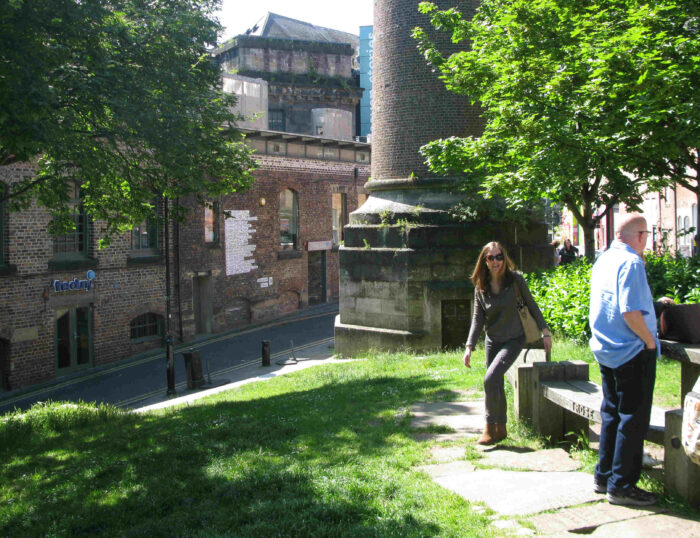
The site saw more change still by 1906, when a large section was converted to become home of the steam-powered Maynards Toffee Factory, answering to a growing demand in Victorian times for sweets. Although the original Dobson steam engine has long gone, the old chimney still stands as a local landmark.
A century later and the factory, after standing derelict for many years, has become a new home for creative industries in the north-east. In December 2011 the building, still known as the Toffee Factory, was remodelled into a block of offices specifically to serve the arts and crafts community. Alongside on the remainder of the site is a new multi-storey residential development.
Lower Steenberg’s Yard was just one example of the pace of industrial change here. Another is The Cluny, one of the largest buildings in the quarter. An imposing Victorian edifice, The Cluny was first constructed as a production centre for the spinning of flax. Later converted into a flour warehouse, and subsequently into a whisky storage centre, the building became derelict as the twentieth century brought different needs and priorities.
Still standing, the now refurbished structure has been given a new purpose. The Cluny has become one of the most important cultural venues in the whole of the city, hosting a pub, a cafe and a 300-seat live-music venue.
Coals to Newcastle
The cluster of heavy crafts and industries in this one small part of Newcastle all had to be powered. And the most obvious resource, coal, was also a local one. Coal has been mined in and around the city since medieval times. The district of Heaton for example, just over a mile east of the city centre, is to all intents and purposes these days just another inner-city suburb.
Yet at one time it sat above an extensive network of coal mines. Indeed, most of the houses here are sat above a mine tunnel of one sort or another. Another more westerly mine was that of the Town Moor, just the other side of the city. These were all private enterprises; the lease on one colliery on Town Moor was advertised as to let in April 1763.
The river Tyne was the obvious place to handle large-scale shipping of coal, and for those mines to the north and west an underground tunnel, the Victoria Tunnel, was dug right underneath the city to provide access to the river. Coal from the Town Moor mine was brought by horse and cart to the tunnel, where it rolled on carts down the length of the tunnel using gravity alone thanks to the design of the gradient inside.
At the south end of the tunnel, the coal would be transferred to small rowed barges or “wherries” lining the banks of the Tyne and the Ouseburn at high tide. The river back then was not dredged, and boats had to run the gauntlet of mud and sandbanks that shifted constantly due to the actions of currents and tide. Thanks to such hazards, anything larger than these small flat-bottomed boats was unable to navigate the river with safety, which for the big ships meant berthing downstream near the river entrance at North or South Shields, and waiting for the wherries.
Coal itself was of course a hugely important export for the city. Local sources estimate that at the mining industry’s peak, over 200 colliers (themselves often large sailing barges or brigs) departed from the Tyne every day, most of them sailing down the east coast to the Thames Estuary to feeding London’s ever-expanding maw for energy.
I doubt that you would have seen many fish in the Tyne at that time. By all accounts the waters of the Ouseburn at the river mouth, and those of the Tyne itself, ran black with coal dust.
Lime Street Slipway – 24 hours a day?
The sea was of course the most important route for moving coal over distance, which is why the Lime Street Slipway, shown on maps from around 1838, was such an important site. Coal had to be transferred from mines to ship, or specifically from the Victoria Tunnel to the sea-going colliers in the Tyne.
The slipway allowed carters to drive their wagons from Lime Street down to the waterline to load their contents onto the wherries. Typically these craft rested on the riverbed at low tide when the Ouseburn was nothing more than a shallow stream, enabling easy transfer of goods to/from the carts alongside.

Come high tide and the wherries could be floated off and rowed out to the ships waiting downstream in the main river. I have no resources to confirm this, but given the demand at the time for coal, I can picture a hive of activity loading and unloading these boats either side of the daytime high tide. I doubt that night-time working would have been feasible at all before the arrival of gas and electric lighting, and by that time regulations on safe working harbourside would also have arrived.
The Lime Street Slipway still stands, although it is quieter now than in its commercial heyday. Clearly visible from the east bank, it provides access to the water for a local motor-boat club specialising in antique craft, some of which look as if they date from the period.
Forging iron and steel
In the 1870s, the Ouseburn Engine Works also operated from the west bank of the river, just north of the Ouseburn bridge. Started by a Scottish engineer called Robert Morrison, the works opened in the early 1850s to manufacture an improved design of steam hammer, used in the forging process of iron and steel components. Such hammers could deliver something like a 125 ton blow to shape a steel plate.
Unfortunately the works had a somewhat chequered history. A serious accident was reported by the Manchester Times on 31st July 1858. “Great sensation was created in the neighbourhood of Ouseburn yesterday morning by a boiler explosion, which occurred a little before six o’clock, at Messrs. R Morrison and Co’s Engine Works. Seven or eight persons were injured, some of them being very seriously scalded. ….. The force of the explosion was tremendous. The boiler went right through the roof of the shed high up into the air, and clearing some sheer legs, which stood about 35 feet high, it passed over the yard, a distance of many yards, alighting on another shed, smashing through the roof, and penetrating right into a new boiler which lay on the floor….” (source: Ouseburn Trust).
They were also plagued, it seems, by financial mismanagement. After a series of bankruptcies under different owners, including even the local cooperative societies, the works finally closed their doors forever in 1881.
Three bridges dominate
Today, any visitor to Ouseburn cannot miss the three bridges that dominate the view. The oldest, a Grade II listed stone and steel construction, is the Ouseburn Viaduct, a 108 feet high rail bridge that first opened in the 1830s, and still carries the East Coast main rail line from London to Edinburgh. On my visit one sunny June morning, an LNER train running southwards from Edinburgh could clearly be seen high above our heads, as it slowed on the approach into Newcastle station.

Another is Byker Bridge, a brick structure from 1878 that connects traffic from the city centre with the eastern suburb of Byker and points east all the way to the coast. Originally privately owned, it had a halfpenny toll, the only way to avoid descending into the bottom of the valley and crossing the Ouseburn at the fords of Sandy Ford or Stony Ford. Purchased at some time in the 1900s by the city council, it is now toll-free.
Most modern is the Byker Metro Bridge, which opened in 1982 as part of the Tyne & Wear Metro network. Built in concrete sections that are apparently glued together with epoxy resin, the bridge was designed by Ove Arup and Partners. Interestingly Ove Arup himself, though Danish, was born less than one mile east on the city’s Heaton Road. And not many people realise that the Metro itself was the first modern light-rail transport system in the whole of Britain (source: Nexus).
Ouseburn today – a social draw
Ouseburn has a fascinating industrial history. And the fact that so much of this history remains visible is hugely important to the quarter. The past may have been about heavy industry – the future (believes the Ouseburn Trust) is about building on the retained character of that past to underpin ideas and creativity.
The streets beneath the Ouseburn bridges these days play host to a variety of artistic and craft ventures, from the wonderful Biscuit Factory (an independent art gallery listed in The Times’ Top Ten Galleries to Visit) to 36 Lime Street, a studio space which houses over 40 artists including sculptors, painters, jewellers, musicians, puppeteers, textile designers and more. They are also home to the Seven Stories, the national centre for children’s books.
I have mentioned a few of the creative spaces and enterprises here. But there are many more. As any wanderer will find, even some of the more run-down looking industrial shacks and other constructions house a surprising number of activities, from band practice places to workshops to social centres.

And the quarter succeeds on the social side also. Workers in the area always needed food and drink, for which they had, and still have, public houses like the Ship Inn, created from the last house in a line of Victorian terraces and believed to be the oldest established pub in the area.
Present-day workers and visitors have The Cluny, a cultural venue that regularly hosts sessions of live music. And of course the ever-popular Tyne Bar, situated by the flood gates where the Ouseburn joins the river Tyne.
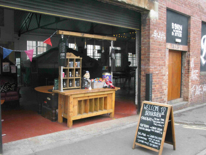
The quarter even has its own microbreweries. Brinkburn St Brewery, Kitchen & Bar on Ford Street has its own basement bar and outside terrace (not to mention some excellent beer). And there is the Out There Brewing Company on Foundry Lane.
I should also mention the Free Trade Inn. Set high on the river bank overlooking the Tyne, the Free Trade is one of Newcastle’s oldest established real-ale pubs. It also enjoys one of the finest views out to the west over the Tyne, at least for the moment (this view is threatened by the proposed, and controversial, Malmo development on the last remaining area of open space on the Tyne’s north bank between Ouseburn and central Quayside). My sympathies are with the historic pub and its customers, but the decision rests with the city council.

The Ouseburn Valley has undergone so much dramatic change over the last two decades. I was a student here in the 1980s, and then the quarter was, like so much else on the urban banks of the rivers Tyne and Wear, largely home to derelict shipyards, disused docks and all the debris of the region’s industrial past.
These areas were interesting. But the crumbling remains of old industries were also depressing, and offered little to local people who had to view them every day. Yet thanks to sustained efforts in recent years from organisations like the Ouseburn Trust, and with financial support from European, national and local governments, the quarter has like most of the post-industrial riverbanks been transformed.
It is to the credit of the Trust and the City Council that this transformation has been achieved in a manner that has kept the reminders of the past, yet repurposed them in an approach that draws human talent, inspires ideas and attracts visitors. There can be no better way in which to rebuild.
© Philip Hunt 2022.
More information
I could not have written this article before going on one of the excellent “Ouseburn- Back to the Future” walking tours run by the Ouseburn Trust. If you want a fascinating insight into the local history of this quarter of the city, then I can heartily recommend them.
More than historical guardian, the Trust remains landlord and active promoter of Ouseburn as a place to create, work and do business. And it does all this as a charity. In my opinion, it deserves the thanks of local people (as well as more support) for preserving what is likely to become one of the more important future destinations within the city. I have seen the draw of such areas in other cities around the world – preserving the character of Ouseburn in the same way is likely to be of huge future benefit.
Northumberland and Newcastle Society
